
Home
Links
Contact
Imprint
Data protection
SSASSCAL ObservationNet
Home
Biodiversity Observatories
Angola
Bicuar National Park
Cameia National Park
Candelela
Cusseque
Espinheira
Tundavala
Namibia
Aussinanis
Claratal
Dieprivier
Duruchaus
Featherlion
Ganab
Garnet Koppie
Gellap Ost
Giribes Leopard Rock
Giribesvlakte
Gobabeb
Haribes
Hartmann Plains
Karios
Kleinberg
Krumhuk
Marble Hill
Marienfluss Valley
Mile 46
Mutompo
Nabaos
Narais
Niko North
Niko South
Ogongo
Okamboro
Omano go Ndjamba
Otjiamongombe
Roessing Mountain
Rooisand
Sandveld
Sonop
Sophies Hoogte
Station 8
Toggekry
Ugab Hills
Vogelfederberg
Welwitschia Vlakte
Wlotzkasbaken
South Africa
Alpha
Cape of Good Hope
Eksteenfontein
Elandsberg
Goedehoop
Koeroegap Vlakte
Moedverloren
Nieuwoudtville
Numees
Paulshoek
Ratelgat
Remhoogte
Riverlands
Rocherpan
Soebatsfontein
Soebatsfontein exclosure
Yellow Dune - Grootderm
Zambia
Dongwe
Kafue National Park (KNP)
Luampa
Home
Vogelfederberg Infosheet
Start page
Shows the list of all observatories. (Home)
Other observatories
The list below shows for which other observatories the following datatype is available:
Observatory Info sheet
(List grouped by Country)
Angola
Bicuar National Park
Cameia National Park
Candelela
Cusseque
Espinheira
Tundavala
Namibia
Aussinanis
Claratal
Dieprivier
Duruchaus
Featherlion
Ganab
Garnet Koppie
Gellap Ost
Giribes Leopard Rock
Giribesvlakte
Gobabeb
Haribes
Hartmann Plains
Karios
Kleinberg
Krumhuk
Marble Hill
Marienfluss Valley
Mile 46
Mutompo
Nabaos
Narais
Niko North
Niko South
Ogongo
Okamboro
Omano go Ndjamba
Otjiamongombe
Roessing Mountain
Rooisand
Sandveld
Sonop
Sophies Hoogte
Station 8
Toggekry
Ugab Hills
Vogelfederberg
Welwitschia Vlakte
Wlotzkasbaken
South Africa
Alpha
Cape of Good Hope
Eksteenfontein
Elandsberg
Goedehoop
Koeroegap Vlakte
Moedverloren
Nieuwoudtville
Numees
Paulshoek
Ratelgat
Remhoogte
Riverlands
Rocherpan
Soebatsfontein
Soebatsfontein exclosure
Yellow Dune - Grootderm
Zambia
Dongwe
Kafue National Park (KNP)
Luampa
Vogelfederberg (A15) - Observatory Info sheet
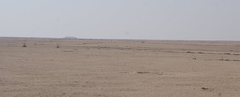
General Data
Number
Name
Alternative Name
A15
Vogelfederberg
n.a.
Implementation
Country
Province/ Region
2016
Namibia
Erongo
District/ constituency
Locality
Farm Name
Swakopmund
Namib-Naukluft Park
Latitude
Longitude
Altitude
-23.098473 S
15.029461 E
538 m a.s.l.
Rainfall Season
Biome
WWF Ecoregion
none
Desert
AT1315 Namib desert
Agro-Ecological Zone
Relative intensity of land use
Tenure
NAM6
Low
State
Type and history of landuse
Land owner
Google Earth
Nature reserve
Government
Google Earth
Key study objective
Rainfall / fog gradient
Data
Climate
Monthly diagrams for: Air Temperature/Rain, Humidity, Solar irradiance
Nearest weather station
Vogelfederberg
Distance to station: 0.07 km
No current weather data available
EVI Viewer
The EVI viewer allows you to access the latest phenology and fire data from the Biodiversity Observatory via the Google Earth Engine Apps.